Hailstorms on the Way for Brisbane & Surrounds
- Weatherwatch
- Aug 13, 2025
- 2 min read
August 13, 2025
Out-of-Season Hail on the Cards
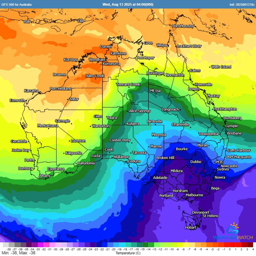
Brisbane and large areas of southeast Queensland (and even northeast NSW) can expect more out-of-season hail and storm activity over the coming days. While there is a chance of some very localised pockets of small hail today - hail will be a far more likely threat tomorrow.
Early Risk Today
A very strong upper trough will approach today, sparking the potential for showers and isolated thunderstorms. While most activity will be brief, one or two cells could produce small, pea-sized hail. Any lightning that occurs will also be quite infrequent.
Much Higher Threat Tomorrow
Tomorrow, the core of the upper trough will sit directly over southeast Queensland, injecting very cold air into the upper atmosphere. Even with surface temperatures only in the low 20s, the atmosphere will be unstable enough for showers and storms to develop.
Instead of rain, much of the precipitation is likely to fall as hail. Fortunately we're not expecting overly large hail, but localised pockets of large hail are possible. The main concern however is the potential for large accumulations of small hail (LASH) which can still bring hazardous conditions - particularly on the road or for crops.
Large amounts of hail can also cause flash flooding due to blocked drains from hail.

Clearer Skies by Friday
This system will rapidly clear eastwards by Friday morning as the upper trough moves offshore, with a return to fine and more stable conditions from Friday onwards which is much more typical for August in the region.
Weatherwatch – your trusted partner in weather intelligence