Widespread Gales & Damaging Winds as Massive Cold Front Approaches
- Weatherwatch
- Aug 27, 2025
- 3 min read
August 27, 2025
A massive and powerful cold front is set to sweep across eastern Australia from Friday, bringing snow to the Adelaide Hills, blizzard conditions to the alpine areas of NSW and Victoria, and widespread damaging winds and gales stretching as far north as southern Queensland.

Gales & Damaging Winds Across Multiple States
It’s already been a windy few days across southeastern Australia, but Friday will see winds increase further. South Australia, western Victoria and much of inland NSW are all in the firing line for widespread gale-force wind gusts of 70-90km/h, with numerous locations likely to see damaging winds.
The greatest concern is around Adelaide and southeastern South Australia where damaging winds may be widespread. By Saturday, these strong winds will contract eastwards into NSW and southeast Queensland with extensive gales likely.

While structural damage is less likely, these winds are more than strong enough to bring down trees and large branches, raising the risk of power outages and property damage. If there’s a day to leave the car in the garage and avoid parking under trees then this is it!
Snow for the Adelaide Hills & Alpine Regions
While heavy snow and potential blizzard conditions will target the usual hotspots across the Victorian and NSW ski fields, the standout surprise will be the Adelaide Hills. Higher elevations here may see flurries on Friday night into Saturday morning as the core of very cold air sweeps through.

Some light snow could even extend into the northern NSW ranges, though nothing like the major event earlier this month. Any falls here will likely remain quite light.
Temperatures to Plunge into Winter’s End
It may feel like spring in Queensland today, but the late-winter warmth will be swept away by cold, windy conditions over the weekend. The last day of winter could prove memorable with widespread frosts across southern Queensland, thanks to dry air, clear skies, and the colder airmass.

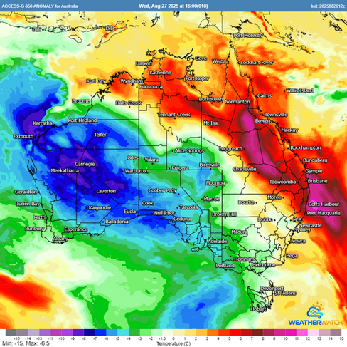


ACCESS temperature anomalies in the lower atmosphere showing well above average temperatures over Queensland today being replaced by much colder and below average temperatures by Saturday. Source: metcentre.io
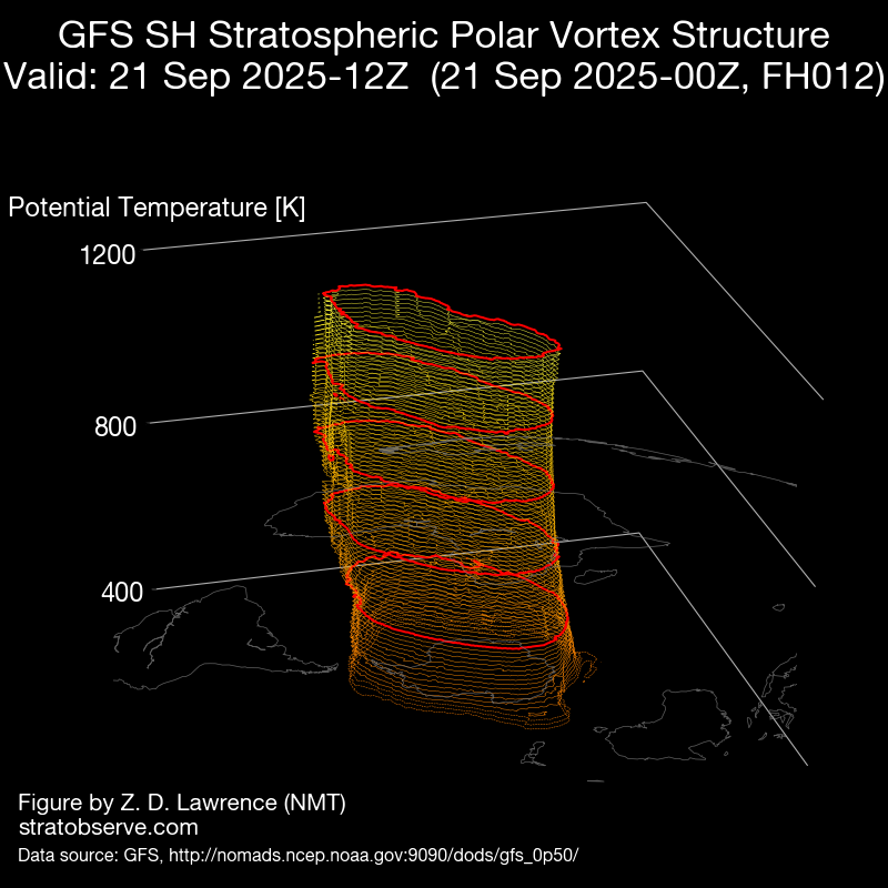
Cold front activity is likely to continue into next week under the current negative SAM pattern, though at this stage, it isn’t expected to be as strong or significant as the upcoming system.
Preparing for the Impacts
This system may cause disruptions ranging from power outages to vegetation damage. Residents and businesses can take the next day or two to prepare for the winds on Friday and Saturday:
Prepare for power outages in areas by keeping phones charged and ensuring you have spare batteries should the power be out at night.
Avoid parking under trees during windy periods. Also take caution if driving in treed-in areas as large branches can come down with little or no notice.
Tie down, bring inside or remove loose objects from your yard. These can fly through the air during strong winds causing impact damage to buildings.
Strong winds at airports may cause travel delays due to reduced runway capacity. Check with your airlines in case of delays or cancellations

While Australia experiences many cold fronts, it's important to note this front will see more widespread impacts than other fronts.
Weatherwatch – your trusted partner in weather intelligence